2 What do we know about it?
Nearshore Australian coastal and marine environments are classified into 60 distinct marine biogeographical regions. Each of these bioregions can be considered a large marine ecosystem, with biological and physical characteristics that are distinct from those elsewhere in Australia. These ecosystems have distinctive oceanographic and ecological characteristics, comprising different proportions of habitat types, and are home to a variety of species, some with only limited distribution. The eight marine bioregions in South Australia—Eucla, Murat, Eyre, Spencer Gulf, North Spencer Gulf, Gulf St Vincent, Coorong and Otway—are shown in Figure 1.
2.1 Bioregional environmental assessment
Key ecosystems, habitats and species that make up the South Australian coastal and marine environments have been assessed; they include seagrasses, reefs, sandflats and mudflats, estuaries, beaches and dunes. The information is provided at bioregional scale, where possible. The assessment of South Australia’s shallow coastal waters is based on a classification system that incorporates seagrass and reef habitat condition indices, and water quality parameters. The classification system is based on a model of change in biological condition along a gradient of human disturbance (Figure 2).
-01_opt.jpeg)
Figure 1 South Australia’s marine bioregions
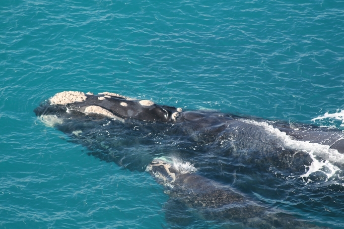
Southern right whale cow and calf, Great Australian Bight Marine Park
Saras Kumar, Department of Environment, Water and Natural Resources
-01_fmt.jpeg)
Source: Gaylard et al (2013)
Figure 2 Ecological condition gradient and classification system for shallow nearshore marine waters in South Australia
Consistent with the model above, ecological condition monitoring by the South Australian Environment Protection Authority (EPA) in 2010 showed that areas located away from nutrient sources were in a better condition.
2.1.1 Seagrasses
Seagrass meadows are recognised globally as being of high value as productive coastal habitats, with numerous vital ecological roles. As well as providing habitat for other organisms, seagrass is also an important source of food for some marine herbivores, and helps to prevent erosion by stabilising sediments. Seagrass is also an important carbon sink (Fourqurean et al. 2012).
There are 21 species in nine genera of seagrass in South Australia, growing in shallow, sheltered bays from Port McDonnell near the Victorian border to Fowlers Bay at the western end of the South Australian coastline. Since the 2008 South Australian state of the environment report (EPA 2008), more detailed information about the extent and cover of seagrass has been obtained for the majority of the state’s shallow coastal waters. The new information provides a baseline against which change in the extent and cover of seagrass meadows can be assessed in the future.
Table 1 provides the bioregional assessment for seagrass.
|
Eucla |
There are no seagrass beds currently mapped in the Eucla bioregion. However, an expedition by Gurgel and others located extensive patches of seagrass beds dominated by Amphibolis antarctica at the Coymbra study site between the beach and the outer limestone reefs (F Gurgel, Department of Environment, Water and Natural Resources, pers. comm., November 2012). The study did not evaluate the condition of the seagrass, and further assessment and mapping are required to determine the condition of seagrass habitats in this bioregion. |
|||||||||||||||||||||||||||||||||||||||||||||||||||||||||||||||||||||||||||||||||||||||||||||||||||
|---|---|---|---|---|---|---|---|---|---|---|---|---|---|---|---|---|---|---|---|---|---|---|---|---|---|---|---|---|---|---|---|---|---|---|---|---|---|---|---|---|---|---|---|---|---|---|---|---|---|---|---|---|---|---|---|---|---|---|---|---|---|---|---|---|---|---|---|---|---|---|---|---|---|---|---|---|---|---|---|---|---|---|---|---|---|---|---|---|---|---|---|---|---|---|---|---|---|---|---|---|
|
Murat |
Fowlers Bay is the last large area of seagrass before the Western Australian border. This bioregion represents 15% of the total area of seagrass recorded in South Australia, covering an area of 86 160 hectares in Streaky Bay and Smoky Bay alone (DEH 2007a). Anecdotal evidence suggests that loss of seagrass beds in Smoky Bay is likely to be due to high levels of nutrient inflow. |
|||||||||||||||||||||||||||||||||||||||||||||||||||||||||||||||||||||||||||||||||||||||||||||||||||
|
Eyre |
The large number of sheltered, sandy embayments in the Eyre bioregion—including Baird, Venus, Waterloo, Sceale, Coffin, Proper, Boston, Louth and Peake bays off Eyre Peninsula, and D’Estrees Bay at Kangaroo Island—boast extensive areas of seagrass meadows, which are estimated to cover an area of 56 956 hectares. The lee side of some islands in the bioregion, such as the Sir Joseph Banks and Investigator groups, provides sheltered conditions and supports dense seagrasses in excellent condition. The seagrasses of the Investigator Group region are expansive and diverse. Almost all known South Australian species have been documented across the region, including six species of Posidonia, two species of Amphibolis, two species of Heterozostera, and Halophila australis (Bryars and Wear 2008). The seagrass meadows in the Investigator Group region are all considered healthy. Within Boston Bay, sea-cage aquaculture, stormwater run-off from Port Lincoln, the Billy Lights Point wastewater treatment plant and fish-processing discharges all contribute nutrients into the sheltered bays. This is likely to contribute to the eutrophic condition of both Boston and Louth bays and subsequent seagrass losses. The remaining seagrass in these bays was in moderate to poor condition, with dense epiphytic algal growth indicating widespread nutrient enrichment in these areas. The seagrasses in other areas of the Eyre region were largely in good condition and the overall condition of the bioregion was considered good. Many of the seagrass meadows in these bays provide habitat and nursery areas for prawns and various fishes of commercial and recreational importance. D’Estrees Bay supports the only seagrass bed on the south coast of Kangaroo Island; this bed is considered to be in very good condition (KI NRM Board 2009). |
|||||||||||||||||||||||||||||||||||||||||||||||||||||||||||||||||||||||||||||||||||||||||||||||||||
|
Spencer Gulf |
Although seagrasses are not widespread in this bioregion, they occur in the more sheltered areas, such as Franklin Harbour in the west, Hardwicke Bay in the east, Port Victoria and areas around the Wardang Island group, and other areas along the mid-east coast (including Balgowan). Highly productive seagrass meadows are also a feature of the Tiparra Reef area, which is exposed to strong currents. There were small stands of seagrass (often interspersed with reef patches or sand) in the south-east of Spencer Gulf, such as off Port Minlacowie and the southern part of Hardwicke Bay. The Environment Protection Authority assessed the ecological condition between Arno Bay and Franklin Harbour as good, while on the eastern side of the gulf, around Moonta and Wallaroo, the ecological condition was classified as excellent with seagrass meadows of Posidonia spp. and Amphibolis spp. Throughout Spencer Gulf there are signs of nutrient enrichment reflected in dense growths of epiphytic algae on the seagrasses, indicating that the habitats are under stress (Gaylard et al. 2013). |
|||||||||||||||||||||||||||||||||||||||||||||||||||||||||||||||||||||||||||||||||||||||||||||||||||
|
North Spencer Gulf |
North Spencer Gulf bioregion’s warm, shallow waters support seagrass beds over 53% of the sea floor, mostly in the central and northern reaches. At 4215 square kilometres (50% of the state’s total seagrass coverage), this is the largest area of seagrass meadows recorded in South Australia, and one of the largest areas of temperate seagrass meadows in Australia. The area has limited water movement and low wave energy, so it is vulnerable to land-based sources of pollution that are not readily dissipated. There has been a loss of Amphibolis antarctica due to exposure to heat and ultraviolet light (Seddon 2000). This trend is expected to continue and might increase with climate change, as temperatures in the gulf rise. |
|||||||||||||||||||||||||||||||||||||||||||||||||||||||||||||||||||||||||||||||||||||||||||||||||||
|
Gulf St Vincent |
Adelaide Metropolitan coastlineSeagrass beds along the metropolitan coastline have been characterised by the loss of more than 5000 hectares of both Amphibolis spp. and Posidonia spp. in the nearshore waters and in several locations adjacent to wastewater discharges, as indicated in the Adelaide Coastal Water Quality Improvement Plan (EPA 2013). The remaining seagrasses are fragmented, leaving them vulnerable to further degradation. The numerous discharges of nutrients and sediment into the coastal waters, and the high residence time of discharges in the nearshore waters, due to lack of mixing with deeper waters are likely to continue to cause further loss of seagrass along this section of coastline. The EPA assessed the shallow waters throughout this part of the coast and determined that the condition was fair, with some areas of intact seagrasses particularly around Semaphore, while the area between Grange and Glenelg was degraded (Gaylard et al. 2013). Although losses have been reported for the deeper waters offshore, recent investigations by the EPA determined the ecological condition to be very good because the meadows surveyed were typically dense with low epiphyte loads in clear water. Further south, the ecological condition of the waters less than 15 metres deep is considered to be poor because the seagrasses are patchy, and there are indications of nutrient enrichment throughout the region. Testing of rehabilitation methods by Irving et al. (2010) found that sand-filled hessian bags provided a viable and cost-effective option for mitigating losses; however, successful long-term recovery will rely on improvements in water quality, as outlined in the draft Adelaide Coastal Water Quality Improvement Plan (EPA 2013). Yankalilla Bay and Light RiverLevels of epiphyte cover observed in Yankalilla Bay are low. Seagrass off the Light River delta is in very good condition and not affected by discharges from the Light River. Northern Gulf St Vincent (Clinton bio-unit)Seagrass meadows dominate the shallow, low-energy environment at the top of Gulf St Vincent and are subjected to large tides and limited water exchange. Overall, the sites were dominated by dense seagrass habitats consisting mainly of Posidonia spp. and Amphibolis spp., and the region was considered to be in very good condition. However, there are emerging signs of nutrient enrichment, which might lead to seagrass loss in the future (Gaylard et al. 2013). Yorke Peninsula (Orontes bio-unit)The low–wave energy environment of western Gulf St Vincent sustains large seagrass meadows between Ardrossan and Troubridge Island. Recent investigations by the EPA classified the ecological condition of the region as very good, but large parts of the region were under significant stress because of nutrient enrichment, particularly near small coastal developments such as Black Point and Wool Bay (Nelson et al. 2013). Kangaroo Island (Nepean bio-unit)The northern coast of Kangaroo Island is dominated by seagrass-filled embayments punctuated by rocky headlands. In some of these bays, there is evidence that seagrass meadows are degraded and seagrass habitat has been lost (Western Cove), probably as a result of eutrophication (Bryars et al. 2003, Gaylard 2005). The region was assessed as generally in good condition, but in some areas the seagrass was significantly impacted (such as Western Cove) while in others (such as Bay of Shoals) it was in good condition. Throughout the region there were heavy epiphyte loads on seagrasses, indicating that the area is under stress from excess nutrients (Gaylard et al. 2013). |
|||||||||||||||||||||||||||||||||||||||||||||||||||||||||||||||||||||||||||||||||||||||||||||||||||
|
Coorong |
Seagrass beds are scarce along most of the coast because of high wave energy and active sand movement. In the more sheltered waters of Lacepede Bay, there is a dense and extensive seagrass meadow (25 062 hectares). This meadow is vulnerable to the impacts of high-nutrient water flowing from agricultural drains and coastal development. There is little seagrass north of the Granites because of higher wave power; some patches of seagrass are interspersed between reefs and sandy areas in the western part of the bioregion. The nearshore seagrass has regressed approximately 100 metres offshore in front of the township of Kingston. |
|||||||||||||||||||||||||||||||||||||||||||||||||||||||||||||||||||||||||||||||||||||||||||||||||||
|
Otway |
Seagrasses are a minor feature of the Otway bioregion. The most easterly bed of Posidonia is found at Port MacDonnell, and other small patches occur near Beachport and Boatswain Point. Seagrass meadows in the Otway bioregion are dominated by strapweed (Posidonia australis), wire grass (Amphibolus antartica) and eelgrass (Heterozostera tasmanica). Historical seagrass loss documented in Rivoli Bay has been attributed to the impacts of drain discharges (Seddon et al. 2003). The remaining seagrass in the bay is vulnerable to high wave energy and seabed instability resulting from the previous losses (Wear et al. 2006). |
|||||||||||||||||||||||||||||||||||||||||||||||||||||||||||||||||||||||||||||||||||||||||||||||||||
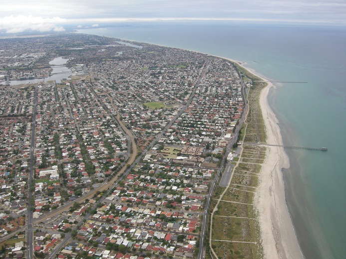
Adelaide coastline, looking south from Port Adelaide
Dr Jane McKenzie
2.1.2 Reefs
The strip of land that fringes the sea and lies between the extremes of tides constitutes an important series of coastal environments. Intertidal rocky reefs help to reduce the impact of high-energy wave action on coastal zones, preventing erosion of sandy beaches. Covered by high tides but exposed during low tides, these intertidal zones are one of the most accessible parts of the marine environment for human recreation and other pursuits. They also suffer the highest impact from pollution and harvesting. With continued population growth, these intertidal areas are likely to undergo considerable change. The health of most reefs in South Australia is not known because of limited monitoring.
Table 2 provides the bioregional assessment for reefs.
|
Eucla |
Of the habitats that have been mapped in the Eucla bioregion, approximately 12.5% are subtidal reef. Isolation and difficult coastal access have helped to ensure that the environments of the Great Australian Bight are relatively pristine. The marine habitats of the Alinytjara Wilurara Natural Resource Management Region have not been systematically surveyed because of the relative inaccessibility of the area; therefore, no overall trend can be assigned. Surveys around the Bunda Cliffs considered the seascape to be excellent (AW NRM Board 2011). |
|||||||||||||||||||||||||||||||||||||||||||||||||||||||||||||||||||||||||||||||||||||||||||||||||||
|---|---|---|---|---|---|---|---|---|---|---|---|---|---|---|---|---|---|---|---|---|---|---|---|---|---|---|---|---|---|---|---|---|---|---|---|---|---|---|---|---|---|---|---|---|---|---|---|---|---|---|---|---|---|---|---|---|---|---|---|---|---|---|---|---|---|---|---|---|---|---|---|---|---|---|---|---|---|---|---|---|---|---|---|---|---|---|---|---|---|---|---|---|---|---|---|---|---|---|---|---|
|
Murat |
Of the habitats that have been mapped in the Murat bioregion, 17.2% are subtidal reef. Reefs in the bioregion, including rocky parts of bays, headlands and around islands, support a diverse cover of brown canopy macroalgae (including various species of Cystophora and Sargassum), and many species of red algae. Nuyts Reef, Fowlers Bay and Point Bell are characterised by a diversity of red algae. The diverse assemblages of algae provide an important food source for herbivores and habitat for other animals. |
|||||||||||||||||||||||||||||||||||||||||||||||||||||||||||||||||||||||||||||||||||||||||||||||||||
|
Eyre |
The coast of the Eyre bioregion alternates between intermittent, island and reef exposures. There is a highly diverse range of subtidal reef habitats, including ledges, boulders, caves, crevasses, overhangs, cobble reefs, wave-exposed granite outcrops and reef platforms. In some parts of the Eyre bioregion, reefs extend from intertidal wave-cut shore platforms to at least 50 metres deep. Reefs at the bottom of Yorke Peninsula and Eyre Peninsula support different assemblages, despite their geographic proximity. These reefs generally have a large diversity and abundance of invertebrates (sponges, ascidians, bryozoans and hydroids), including some rare and uncommon species. The condition of two reefs within the Eyre bioregion, located around the toe of Yorke Peninsula, has been described as typical through Reef Health surveys (DEH 2008). Parts of the west and south coast of Kangaroo Island also support a dense cover of macroalgae, including regionally unusual assemblages. Intertidal reefs (rocky shores) are a common feature of the coastline of Kangaroo Island and have high invertebrate and algal diversity. Two sites in this area—Browns Beach and Hanson Bay—are identified as having higher species richness than other Australian temperate coastlines (KI NRM Board 2009). |
|||||||||||||||||||||||||||||||||||||||||||||||||||||||||||||||||||||||||||||||||||||||||||||||||||
|
Spencer Gulf |
The Spencer Gulf shoreline includes a wide variety of bedrock platforms and intertidal reefs. Although a large portion of the inshore benthic habitats have been mapped, the condition of ecological communities is still largely unknown. |
|||||||||||||||||||||||||||||||||||||||||||||||||||||||||||||||||||||||||||||||||||||||||||||||||||
|
North Spencer Gulf |
The only intertidal reef in the North Spencer Gulf bioregion is found around Black Point and Point Lowly. It consists of a platform of plate-like fragments, which extends out beyond the intertidal zone and gradually becomes low-relief subtidal rocky reef out to 70–130 metres offshore. The subtidal reef around Point Lowly is recognised as an important area for spawning aggregations of the Australian giant cuttlefish Sepia apama. The area also provides habitat for the many species and abundant numbers of echinoderms, including sea urchins, molluscs and ascidians (sea squirts). The overall condition of these reefs is not known. A decline in numbers of cuttlefish in 2011 has prompted an extension of the protection area and an investigation by the South Australian Government (PIRSA 2012ab). |
|||||||||||||||||||||||||||||||||||||||||||||||||||||||||||||||||||||||||||||||||||||||||||||||||||
|
Gulf St Vincent |
Intertidal reefs in the Gulf St Vincent bioregion are typically calcareous or limestone rock platforms. Intertidal limestone reefs occur at Aldinga Reef Aquatic Reserve and Lady Bay. Harder reefs of granite, basalt and volcanic conglomerates occur at Second Valley and Hallett Cove. Around the tip of Fleurieu Peninsula, the intertidal zone occurs as a narrow band adjacent to sheer coastal cliffs, and is little studied. The intertidal communities vary according to wave exposure and type of substrate. Red and brown leafy algae dominate lower intertidal zones on cliffs of hard crystalline rock around the high-energy tips of Yorke and Fleurieu peninsulas and some nearshore islands. Above the algae, layers of polychaete worms, green algae, barnacles and limpets can be observed, while little blue snails appear in crevices. In 2006–07, results of surveys of 15 intertidal reefs around Fleurieu Peninsula suggested that, in general, these reefs were in good health, with diverse invertebrate communities at most sites and no introduced species. The lowest invertebrate biodiversity was recorded within the Noarlunga Reef and Aldinga aquatic reserves, where there was heavy recreational traffic. Lady Bay on Fleurieu Peninsula appeared to have a higher intertidal species richness (AMLR NRM Board 2008). The remote boulder fields found at Myponga and Kings Beach, near Victor Harbor, indicated high invertebrate biodiversity, probably due to the lack of disturbance. Relatively low diversity recorded within boulder field areas at Aldinga Aquatic Reserve appeared to be due to unusually abundant populations of the predatory crab Ozius truncatus. The unusually high densities of scavenging and predatory crustaceans within these aquatic reserves might indicate disruptions to the normal ecological balance (AMLR NRM Board 2008). Research is required to determine the role of predatory crabs in marine systems. Biodiversity surveys were undertaken at the Port Stanvac intertidal reef in 1988, in 1998 and at the end of 2007. According to Dutton and Benkendorff (2008), the Port Stanvac area appears to have biological importance for intertidal diversity along the Adelaide metropolitan coast and Fleurieu Peninsula. The surveys identified Port Stanvac as an important reef in the region for molluscs, echinoderms and red algae, because it supports rare species that have not been recorded to date on other intertidal reefs in South Australia. Over the past 20 years, there appeared to be an overall increase in the number of taxa found. The subtidal rocky reefs in the Gulf St Vincent bioregion were dominated by large macroalgae and abundant invertebrate life, such as sponges, bryozoans, ascidians, hydroids, echinoderms, molluscs and crustaceans. The reefs also provided abundant habitat for several species of fish, including the western blue groper, the western blue devil, the harlequin and several species of wrasse. Based on the health indices developed during the Reef Health surveys, many of the reefs along the metropolitan coastline have a health status index of caution (Turner et al. 2007). Reefs that were considered good were predominantly in the south and nonmetropolitan areas. There is a general trend for the condition of Adelaide metropolitan reefs to improve in condition from north (worst condition) to south (best condition) (Westphalen 2011). A preliminary baseline investigation of the sedimentation on 12 metropolitan reefs was conducted over winter, summer and autumn from 2007 to 2008. Spatial variation in reef sedimentation was found along the metropolitan coast. The highest amount of sedimentation was found between Hallett Cove and Southport near the mouth of the Onkaparinga River (fluvial origin), and in autumn (Turner et al. 2007). The ecological condition for waters less than 15 metres deep in the area between Marino and Sellicks was considered to be fair. Based on the presence of larger brown algae and the number and diversity of fish as a measure of coastal reef health (Turner et al. 2007), the subtidal reefs on Kangaroo Island could be considered to be in good condition, since they are covered in a dense canopy of macroalgae and have a high fish diversity and abundance (Brock and Kinloch 2007). |
|||||||||||||||||||||||||||||||||||||||||||||||||||||||||||||||||||||||||||||||||||||||||||||||||||
|
Coorong |
Most of the reef habitat within the Coorong bioregion is subtidal; there is only a small portion of intertidal reef. Limited research has been conducted on the intertidal reefs in this region, and little is known about their condition. Subtidal reefs include low platform reefs, offshore calcareous reefs to the south, and fringing granite reefs in Encounter Bay. Much of the sea-floor habitat for this region is unmapped. Low platform reefs, approximately 4.5 kilometres offshore, run parallel along much of the Coorong coast. Many of these reefs are covered in sand as a result of the high turbulence in the region, and few plants and animals are found on them. In the western part of the bioregion, near Port Elliot, there is a series of reef structures, which are complex as a result of the presence of ledges, crevices and cracks. They are ideal habitat for adult and juvenile rock lobsters. In the shallow high-energy areas, reef systems are mostly dominated by kelps and other tough, brown, branching algae, with a diverse understorey of green and red foliose algae, and crustose coralline algae. The latter is a known habitat for juvenile abalone. The reefs at the southern end of Lacepede Bay are dominated by a different mix of algae, with an abundance of bryozoans in waters deeper than 20 metres. In the southern part of the Coorong bioregion, mixed patch reef and sand habitat is dominated by coarse sediments, bryozoans and mixed red macroalgae to a depth of at least 35 metres. Surveys have also revealed the presence of offshore reefs dominated by invertebrates and immobile filter feeders, rather than algal species. In deeper water (more than 25 metres), the flat calcareous platform reefs contain many holes and crevices and are a major habitat for rock lobster, sponges and other benthic invertebrates. The parallel calcareous reefs in this area stretch from the Coorong to Cape Jaffa, on the Lacepede Shelf, from a depth of around 11 metres to 60 metres. Margaret Brock Reef, west of Cape Jaffa and at the southerly extent of the Coorong bioregion, is located in the transition between two biogeographical regions. Giant kelp, which typically dominates the high-energy reefs of the neighbouring Otway bioregion and other cold-water areas of south-eastern Australia, is found on the outer, more exposed parts of the reef. This is of special interest because Cape Jaffa represents the most westerly extent of this cold-water plant. |
|||||||||||||||||||||||||||||||||||||||||||||||||||||||||||||||||||||||||||||||||||||||||||||||||||
|
Otway |
In the Otway bioregion, nearshore rocky platforms and rocky intertidal areas provide habitat for an abundance of plant and animal species. Apart from long stretches of high-energy beach, such as the Canunda area, much of the coastline from Cape Jaffa to Cape Northumberland is dominated by flat limestone reefs. The shallow calcareous platform reefs in the Robe area extend to a depth of about 20 metres. In the intertidal area, many rocky pools and crevices contain sea stars, gastropods and bivalve shells, anemones and other invertebrates. There is no condition baseline or benchmark for the general condition of most habitat types in the south-east, including intertidal reefs (SE NRM Board 2010). Margaret Brock Reef, on the boundary between the Coorong and Otway bioregions, is considered to be a ‘hot spot’ of biodiversity. The limestone reefs around Robe and Nora Creina are also considered ecologically important because they provide habitat for various attached and mobile invertebrates, and have a high diversity of brown, green and red macroalgae. |
|||||||||||||||||||||||||||||||||||||||||||||||||||||||||||||||||||||||||||||||||||||||||||||||||||
2.1.3 Sandflats and mudflats
Intertidal habitats provide a transition zone between terrestrial and marine ecosystems. They are narrow in extent but are relatively open systems that rely on other marine habitats for connectivity, and are also regularly inundated by the tides. These habitats create a range of niches for plants and animals that can tolerate the often extreme conditions of wetting, drying, salinity, temperature, exposure to sun and submersion (AMLR NRM Board 2008). Sandy beaches, and estuarine sandflats and mudflats are the soft-sediment habitats within the intertidal zone.
Intertidal flats are generally associated with low-energy coastlines and have complex food webs. The smaller plants and animals provide food for crustaceans, small fishes and shorebirds (some of national and international importance). Mudflats, continually washed by the tide, provide a linking habitat between mangroves and the adjacent seagrass meadows. The larvae of many species settle and grow in these rich feeding areas. Most medium-energy to high-energy beaches are associated with dunes and reef, seagrass or soft-sediment subtidal habitats. As in other subtidal soft-bottomed communities, many tiny plants and animals live within the ‘gaps’ or interstices between the sand grains (Womersley and Thomas 1976). High-energy habitats have coarser and more mobile sand grains and are dominated by burrowing species, including polychaete worms. They also provide foraging areas and habitat for migratory and resident wading birds or shorebirds.
These beach habitats are vulnerable to human impacts from both land-based and ocean-based activities, including coastal development, urban run-off, marine pollution, and recreational activities such as bait digging for fishing and especially driving on beaches. The beaches are also impacted by human collection of living organisms and trampling (AMLR NRM Board 2008, Dutton and Benkendorff 2008).
Soft-sediment bottoms contain a rich infauna and epifauna. The epifauna itself provides a substrate and habitat for a rich fauna and captures the productivity of the water column via its filter feeders. The organisms on the bottom are critically important as food for higher levels of the food web and contribute to maintaining stability of the bottom. Soft-sediment habitats are vulnerable to any activities that disturb the seabed. These can result from urban and industrial development, and include dredging and dumping, stormwater run-off, sewage and industrial discharges, and trawling. Knowledge of the condition of these habitats is very poor.
Table 3 provides the bioregional assessment for sandflats and mudflats.
|
Eucla |
Intertidal soft sediment includes the Merdayerrah Sandpatch (a geological monument at the most western edge of the bioregion). East of the Bunda Cliffs and Head of Bight to Cape Adieu, the coastline is characterised by beaches backed with dune barriers and interspersed with rocky headlands and reefs. The wave-exposed beach habitats are in some areas backed by a large and dynamic dune system, and fronted by sandbars. The vast stretches of relatively undisturbed beach coastline are used by birds, including little penguins, hooded plovers and oystercatchers (AW NRM Board 2011). A lack of coastal development and limited exploitation or harvesting of coastal resources mean that the nearshore and coastal environments are pristine compared with other coastal areas in South Australia. The only exception is the impact of four-wheel-drive vehicles associated with fishing (AW NRM Board 2008). Soft sediments form the majority of the Eucla bioregion benthic environment (i.e. the environment associated with the sea floor). Filter-feeding invertebrate animals, such as sponges, ascidians and bryozoans, are a dominant feature of the sea floor in the shelf waters of the Eucla bioregion. These invertebrates, particularly the larger sponges, form three-dimensional structures on the sea floor. For many fish and mobile large invertebrates in the Great Australian Bight, the invertebrate-covered sea floor provides areas for feeding, breeding, camouflage and shelter. |
|||||||||||||||||||||||||||||||||||||||||||||||||||||||||||||||||||||||||||||||||||||||||||||||||||
|---|---|---|---|---|---|---|---|---|---|---|---|---|---|---|---|---|---|---|---|---|---|---|---|---|---|---|---|---|---|---|---|---|---|---|---|---|---|---|---|---|---|---|---|---|---|---|---|---|---|---|---|---|---|---|---|---|---|---|---|---|---|---|---|---|---|---|---|---|---|---|---|---|---|---|---|---|---|---|---|---|---|---|---|---|---|---|---|---|---|---|---|---|---|---|---|---|---|---|---|---|
|
Murat |
Surf beaches and sheltered beaches are scattered within the Fowlers Bay area; they are less common in the Streaky Bay area because many of the embayments are dominated by mangrove and saltmarsh habitats (DEH 2007a, EP NRM Board 2009). Where reefs protect the coastline, the beach profiles tend to be shallow. This contrasts with exposed beaches on the western side of Murat, which are generally deeper and accumulate bigger sand-dune systems. Shallow, sandy bays, mudflats and tidal areas in mangrove forests provide key nursery habitat for fish and western king prawns. Many species of fish and birds, including migratory birds, visit these areas to feed. Subtidal soft sediments are not a dominant feature of the Murat bioregion, accounting for only 4% of its area. |
|||||||||||||||||||||||||||||||||||||||||||||||||||||||||||||||||||||||||||||||||||||||||||||||||||
|
Eyre |
There are many small sandy beaches that are open to high-energy wave action between the calcarenite cliffs, or at bases of cliffs, in the western area of this bioregion. The beaches along the lower Spencer Gulf are generally low-energy environments, either reflective or low-tide terraces. They are typically dominated by low-wind waves and are commonly fronted by seagrass meadows. The Eyre, Jussieu and Bolingbroke peninsula beaches are mostly sheltered from south-westerly swells, and this has helped to form a series of bays and estuaries, sandy beaches and rocky shores (DEH 2007b). Wader birds, which are protected by bilateral agreements between Australia and China, Japan and the Republic of Korea, use the tidal flats and beaches throughout the region (DEH 2007ac, DSEWPaC 2009a, EP NRM Board 2009). Much less is known about the condition of intertidal soft-sediment habitats and communities in this bioregion than about their extent. The Kangaroo Island Natural Resources Management (NRM) Board (KI NRM Board 2008) reported that many of the island’s coastal and marine ecosystems were in good condition (as a result of the low level of coastal development), but recognised that data were patchy. Water quality in the nearshore environments on the Eyre Peninsula (Boston Bay, Coffin Bay, Venus Bay) was relatively good, with the lowest nutrient levels recorded of the Environment Protection Authority’s 65 ambient water-quality monitoring sites. Sandy bottom forms a large proportion of the region’s mapped benthic habitat. Soft-sediment communities are found in sheltered embayments; they support a large variety of invertebrates, particularly molluscs and worms, and provide habitat for various fishes and crustaceans. |
|||||||||||||||||||||||||||||||||||||||||||||||||||||||||||||||||||||||||||||||||||||||||||||||||||
|
Spencer Gulf |
The beaches of Spencer Gulf are generally low-energy environments and are dominated by low-wind waves, with greater tidal ranges in the upper reaches. The Eyre Peninsula beaches are mostly protected from the south-west swell, and waves generally develop from onshore winds. Most beaches have wide intertidal sand flats, backed by very low-energy to moderate-energy high-tide beaches, with extensive seagrass meadows at the front (EP NRM Board 2009). Much of the mid-eastern side of the gulf comprises long, sandy beaches with a single or narrow belt of dunes behind, interspersed with small rocky headlands, and shore platforms. Much less is known about the condition of intertidal soft-sediment habitats and communities in this bioregion than about their extent. Water quality in the nearshore environments at Port Hughes is relatively good. Subtidal soft sediments are a feature of the sheltered waters in the northern parts of the Spencer Gulf bioregion. |
|||||||||||||||||||||||||||||||||||||||||||||||||||||||||||||||||||||||||||||||||||||||||||||||||||
|
North Spencer Gulf |
Coastal geomorphology north of Point Lowly consists of wide supratidal samphire and mudflats, intertidal mudflats, mangroves and sandflats. The supratidal zone comprises mainly of bare carbonate flats, which are occasionally inundated by high spring or storm tides. The diversity and productivity of the area are increased by the tidal currents of the northern gulf region. The majority of the beaches have wide intertidal sandflats, backed by very low-energy to moderate-energy high-tide beaches, with extensive seagrass meadows at the front. A distinctive feature of North Spencer Gulf is the unusual coastal sand barriers, which are absent from higher energy stretches of the lower gulf and form under the influence of storm surges or extreme tidal events. About 340 of these barriers are arranged in lines parallel to the shore along the sheltered shoreline, from Cowell to Port Augusta. They average 400 metres long, 10–50 metres wide, and rarely more than 1 metre high. Landward of the actively forming barrier islands are multiple lines of earlier stranded barriers, separated by supratidal flats that are active only when flooded by spring high tides and storm surges. Soft-sediment communities form a large proportion of the North Spencer Gulf bioregion. |
|||||||||||||||||||||||||||||||||||||||||||||||||||||||||||||||||||||||||||||||||||||||||||||||||||
|
Gulf St Vincent |
This bioregion is home to a diverse group of soft-sediment communities, which were identified as six distinct assemblages by Shepherd and Sprigg (1976). More recent surveys (Tanner 2005) report declines or losses in all of these assemblages, both within the gulf and in Investigator Strait. The losses were linked predominantly to prawn trawling, but other impacts, such as dredging and wastewater discharges, also contributed. Sandy to muddy tidal flats dominate the upper portion of Gulf St Vincent from Port Clinton to Port Adelaide (Womersley and Thomas 1976, AMLR NRM Board 2008). Mudflats on eastern Gulf St Vincent are associated with coastal mangroves, samphire habitats and seagrasses. Overall, beach biodiversity in gulf waters is relatively modest (AMLR NRM Board 2008). Dissipative beaches, which are around the eastern Fleurieu coast towards Goolwa, are rich in fauna (AMLR NRM Board 2008). Tidal mudflats and other habitats in Gulf St Vincent are nationally and internationally important for wading birds or shorebirds. The Kangaroo Island NRM Board (2008) reported that many of the island’s coast and marine ecosystems were in good condition (as a result of the low level of coastal development), but recognised that data were patchy. A link has been found between nitrogen (particularly ammonia) in the nearshore regions of Nepean Bay and seagrass loss in the Kangaroo Island region (Bryars et al. 2006). Monitoring indicated that water quality along the metropolitan coast was in poor condition for several indicators and continues to decline. Results from an ecological assessment in 2011 of Adelaide’s beach-nourishing program showed that 58 macroinvertebrate taxa and 558 individuals were found across the 15 metropolitan beaches studied. The most dominant taxa of invertebrates found were typically terrestrial species (mostly beetles). The total number of species found ranged between 77 at Semaphore South and 8 at Torrens Outlet. |
|||||||||||||||||||||||||||||||||||||||||||||||||||||||||||||||||||||||||||||||||||||||||||||||||||
|
Coorong |
The Coorong bioregion is a large, sandy ‘barrier coast’, dominated by large dunes, beach ridges and high-energy sandy beaches, including one of Australia’s longest continual sandy beaches (194 kilometres from the Murray mouth to Cape Jaffa). The lengthy ocean beach is an important feeding, breeding and nursery area for many marine species, including Australia’s largest single population of cockles. The region is also an important nesting site for the state’s listed vulnerable hooded plover and for migratory wading birds (SE NRM Board 2010). The condition and trends of the intertidal coastal environment in the south-east are unknown because of inconsistent and insufficient information (SE NRM Board 2010). The region directly offshore from the Murray mouth is characterised by fine sediments. The high energy and constant sand movements in this area prevent immobile species from settling, but are also likely to provide habitat for bottom-dwelling and burrowing invertebrates. Animals associated with these sandy areas include flatfishes (e.g. flounder and flathead); rays and skates; worms; crustaceans, such as sand crabs; sea snails; and a variety of bivalve molluscs, including the well-known Goolwa cockle or pipi. |
|||||||||||||||||||||||||||||||||||||||||||||||||||||||||||||||||||||||||||||||||||||||||||||||||||
|
Otway |
The intertidal and subtidal areas in the Otway bioregion are dominated by both flat and high-relief limestone reefs, patches of sand, and small areas of seagrass in some of the more sheltered bays. Where reefs are absent, sandy beaches and coastal dunes and barriers can be found. Subtidal soft-bottom habitats are not a dominant feature of the Otway bioregion, accounting for approximately 7% of its area. They are mostly found as patches of sand interspersed among the reefs. |
|||||||||||||||||||||||||||||||||||||||||||||||||||||||||||||||||||||||||||||||||||||||||||||||||||
2.1.4 Coastal water quality
The coastal waters of South Australia are typically low in nutrients (oligotrophic) and clear, and the plants and animals have evolved to thrive in these conditions. Consequently, even small increases in nutrient concentrations can have disproportionate degenerative effects on biotic environments. These effects include increasing epiphyte loading on seagrass, and a shift from canopy macroalgal ecosystems to turf-dominated reef ecosystems.
The pressure on water quality in the lower Spencer Gulf comes from sea-cage aquaculture of both southern bluefin tuna and yellowtail kingfish in the waters offshore from Port Lincoln. The cumulative effect of many farms in this region is discharge of high loads of nutrients into waters. Although the bulk of the aquaculture farms are located well offshore, the wind and tidal action drives the nutrients into nearshore areas such as Louth Bay. Monitoring at Louth Bay in 2010 showed the seagrasses were in poor condition, with signs of excess nutrients, particularly during autumn. Other nutrient sources in this region include run-off from agriculture into the Tod River in periods of heavy rain, and leakage from septic tanks located near small coastal towns. Within Boston Bay, stormwater run-off from Port Lincoln, the Billy Lights Point wastewater treatment plant and fish processing discharges all contribute nutrients into the sheltered bays. This is likely to contribute to the eutrophic conditions found in both Boston and Louth bays.
Other parts of the Lower Spencer Gulf region, including Tumby and Arno bays, receive nutrients discharged from sea-cage and land-based aquaculture, septic-tank leakage and agricultural run-off. The ecological condition monitored in 2010 in these regions was considered to be good. The Lower Spencer Gulf has a variety of pressures that are likely to affect the ecological condition of the receiving waters.
Adelaide’s metropolitan coast receives nutrient-rich discharges from three wastewater treatment plants, as well as from a large manufacturer of soda ash and sodium bicarbonate. These discharges contribute nutrient loads into the marine environment. The nutrients promote the growth of fast-growing epiphytes, which smother seagrasses, reduce the amount of light available to seagrass leaves or result in breakage of leaves. A program to reduce the impacts from these discharges shows promising results (see Section 4).
Urban stormwater contributes large loads of suspended solids into nearshore coastal waters after periods of rain. This discoloured water is retained in the nearshore waters, where it can decrease the clarity of the water and the amount of light available to seagrass and algae. This problem is exacerbated by the suspended sediments and dead seagrass being discharged into the nearshore waters from dredging at boating facilities such as West Beach and North Haven. To date, the combination of increases in nutrients and decreases in water clarity has resulted in a loss of over 5000 hectares of seagrass and the degradation of rocky reefs along the Adelaide metropolitan coast. Seagrass planting trials in areas where water quality has improved are showing positive results.
The northern and eastern Yorke Peninsula is subject to a variety of pressures, including high densities of septic tanks, which result in the leakage of nitrogen through the groundwater into the nearshore marine environment. Present and past land management practices on Yorke Peninsula (in addition to stormwater run-off from coastal towns) transport nutrients and sediment into the nearshore waters after rain, which could lead to future loss of seagrass.
The southern region of Gulf St Vincent receives nutrient-rich and sediment-rich run-off that is discharged from agricultural lands, particularly into the Cygnet River bay on Kangaroo Island. These discharges can cause the degradation of seagrass and rocky reefs, reducing biodiversity and impacting on commercial and recreational fisheries. In addition to agricultural run-off, high densities of septic tanks in coastal towns can result in nutrient discharges to the nearshore environment. To date, there has been a loss or degradation of more than 2695 hectares of seagrass from Western Cove. Additionally, monitoring between 2009 and 2011 indicated that additional seagrass habitats throughout Nepean Bay are under stress from nutrient enrichment, and further seagrass loss is possible.
A study of metal uptake in translocated bivalve mussels throughout South Australia showed that some areas had relatively high metal levels (Gaylard et al. 2011). An association existed between metal levels in the translocated mussels and the broad land use (rural, urban or industrial). The highest metal levels occurred in areas that have a long history of industrialisation, including Port Pirie, Whyalla and the Port River. Urban areas, including the majority of Adelaide’s metropolitan coast, showed a slight elevation in levels of metals, which were largely associated with discharges such as stormwater and water from the Glenelg wastewater treatment plant.
2.1.5 Estuaries
In South Australia, an estuary has been defined as ‘a partially enclosed coastal body of water, including its ecosystem processes and associated biodiversity, which is either permanently, periodically, intermittently or occasionally open to the ocean within which there is a measurable variation in salinity due to the mixture of seawater with water derived from on or under the land’ (Natural Resources Management Act 2004). Estuaries are critical transition zones linking land, freshwater habitats and the sea. They provide many ecosystem services and functions, including erosion control and storm-surge protection, filtration of water as it flows from land to sea, regulation and cycling of nutrients, and habitat for plants and animals.
South Australian estuaries are generally poorly understood and often under threat from a range of sources. The Department of Environment, Water and Natural Resources (DEWNR) mapped 102 estuaries, and 25 of these were surveyed to assess their condition (Rumbelow et al. 2010).
These surveys showed that a high percentage of estuaries across the state have moderate to high levels of disturbance for each threatening process. Threatening processes included altered water regime, physical barrier (mouth, middle or lateral, and head), dumping, habitat fragmentation, overgrazing, nutrient enrichment, vermin, tracks, weeds, vegetation destruction, impacts from recreation, vegetation buffer disturbance, erosion, marine debris, aquaculture and potential marine pathogens (Figures 3 and 4). Some locations showed low dissolved oxygen levels.
-01_fmt.jpeg)
Source: Rumbelow et al. (2010)
Figure 3 Number of estuaries with particular land use directly adjacent to estuary boundaries
-01_fmt.jpeg)
Source: Rumbelow et al. (2010)
Figure 4 Extent of threatening processes across estuaries surveyed in South Australia
These results highlight how estuarine systems around the state are considerably affected by threatening processes. Each of the sites surveyed was subject to multiple disturbances, and many had a high level of impact. These surveys need to be repeated, and the number of sites need to be increased to cover all marine bioregions.
2.1.6 Beaches and dunes
All of the 1788 beaches along the South Australian coast have been mapped and described. They have also been classified according to physical characteristics and safety (Short 2001). In addition, the Coast Protection Board funds a coastal survey program that monitors the condition of beaches that are critical to protecting infrastructure from coastal erosion. These are located mainly in townships and are regularly profiled to detect loss of beach volume, a fall in beach height or foreshore erosion.
Adelaide’s metropolitan beaches have declining sediment and require management to prevent erosion. The 30-kilometre Adelaide beach, for example, has declining sediment due to a reduced sand input and a northward littoral drift. It has been necessary to combine rock-wall protection with a sand management program to protect coastal infrastructure and development from erosion. Beach levels and volumes are monitored, and this information is used to guide the beach replenishment program. Sand is currently shifted using trucks; since 2012, a sand-pumping system has been operational south of Torrens Inlet. Figure 5 has been compiled from DEWNR’s beach-monitoring data. It compares the 2008 beach volumes at 60 monitored locations along the Adelaide coast with 2009, 2010 and 2011 values. Differences between years can be observed at some locations, reflecting both natural sand transport processes and human intervention.
-01_fmt.jpeg)
Source: Department of Environment, Water and Natural Resources
Figure 5 Variation in volumes of beach sediment, 2009–11
2.2 Threatened species
Threatened and rare coast and marine species are protected under the National Parks and Wildlife Act 1972 and the Fisheries Management Act 2007. Species protected under the National Parks and Wildlife Act can be listed as endangered, vulnerable or rare (Table 4).
A comprehensive desktop review was undertaken for many species, including more than 200 species of noncommercial fish, to determine their conservation status. However, most species are deficient in data that could determine their conservation status. One example is the harlequin fish Othos dentex, a coastal reef fish endemic to Australia and occurring from the central coast of Victoria to south-west Western Australia (Atlas of Living Australia 2012). The harlequin fish prefers high-quality coastal waters less than 45 metres deep, and rocky reefs with drop-offs, caves and ledges. The fish, which grows to 76 centimetres in length, is incidentally captured on hook and line by commercial, recreational and charter-boat fishers, is targeted by recreational spear fishers, and is taken as bycatch in commercial and recreational lobster pots.
The Adelaide and Mount Lofty Ranges Natural Resources Management (NRM) Board commissioned a survey of the species and concluded that population estimates were not possible at the sites surveyed because of the low numbers observed—only three individuals were photo-catalogued at Aldinga Reef, and none were sighted at Seacliff, Northern Outer, Macs Ground or Milkies reefs. Further studies are needed to better ascertain the status of the harlequin fish and the many other species of conservation concern in South Australian waters (Bryars 2011). (See the Introduction for more information about NRM regions.)
Coast and marine species protected under South Australian legislation
National Parks and Wildlife Act
- Endangered
- Blue whale (Balaenoptera musculus)
- Subantarctic fur seal (Arctocephalus tropicalis)
- White-bellied sea eagle (Haliaeetus leucogaster)
- Osprey (Pandion haliaetus)
- Yellow-nosed albatross (Indian Ocean subspecies) (Diomedea chlororhynchos carteri)
- Yellow-nosed albatross (Atlantic Ocean subspecies) (Diomedea chlororhynchos chlororhynchos)
- Royal albatross (northern subspecies) (Diomedea epomophora sanfordi)
- Sooty albatross (Diomedea fusca)
- Little tern (Sterna albifrons)
- Fairy tern (Sterna nereis)
- Loggerhead turtle (Caretta caretta)
- Vulnerable
- Southern right whale (Eubalaena australis)
- Sei whale (Balaenoptera borealis)
- Fin whale (Balaenoptera physalus)
- Humpback whale (Megaptera novaeangliae)
- Australian sea lion (Neophoca cinerea)
- Hooded plover (Thinornis rubricollis)
- Buller’s albatross (Diomedea bulleri)
- Shy albatross (Diomedea cauta cauta)
- Salvin’s albatross (Diomedea cauta salvini)
- Grey-headed albatross (Diomedea chrysostoma)
- Royal albatross (southern subspecies) (Diomedea epomophora epomophora)
- Wandering albatross (Diomedea exulans)
- Black-browed albatross (Campbell Island subspecies) (Diomedea melanophris impavida)
- Light-mantled albatross (Diomedea palpebrata)
- Great skua (Macquarie and Heard Island subspecies) (Catharacta skua lonnbergi)
- Southern giant petrel (Macronectes giganteus)
- Green turtle (Chelonia mydas)
- Leatherback turtle (Dermochelys coriacea)
Fisheries Management Act
- Protected
- Western blue groper (Achoerodus gouldii) in the waters of or near Spencer Gulf and Gulf St Vincent
- Great white shark (Carcharodon carcharias)
- Scalefish of the family Syngnathidae
- Scalefish of the genus Ambassidae
- Scalefish of any species of Mogurnda
- Crustaceans of the following classes carrying external eggs:
- bug (Ibacus sp.)
- blue swimmer crab (Portunus pelagicus)
- giant crab (Pseudocarcinus gigas)
- slipper lobster (Scyllarides sp.)
- southern rock lobster (Jasus edwardsii)
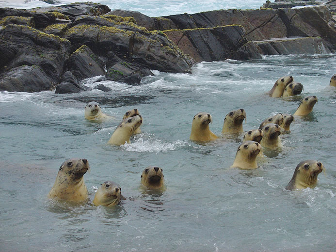
Australian sea lion pups in rockpool at North Page Island
Dr Jane McKenzie