4 What are we doing about it?
Managing the state’s water resources to maximise economic, environmental and social benefit is a critical priority for the South Australian Government and the broader community.
The Natural Resources Management Act 2004 (NRM Act) is the legislative foundation for the sustainable management of water in South Australia. The Environment Protection Act 1993 provides the legislative basis for managing water quality and pollution. The River Murray Act 2003 provides for the protection and enhancement of the River Murray, and related areas and ecosystems.
Although the NRM Act is sometimes thought of as ‘quantity focused’, and the Environment Protection Act as ‘quality focused’, the relationship between quantity (particularly in relation to the suitability of a water resource for use) and quality is well recognised and reflected in the state’s approach to managing its water resources.
Water management arrangements are somewhat complex in South Australia. The Department of Environment, Water and Natural Resources (DEWNR) has the lead for managing the state’s water resources under the NRM Act, including water allocation planning through the NRM boards. The EPA has the lead responsibility for water-quality management; SA Water is the state’s water utility; and the Department of Planning, Transport and Infrastructure manages land-use planning and major infrastructure upgrades that interface with water resources.
Other state agencies with roles relevant to the management and protection of the state’s water resources include the Department for Health and Ageing, which has lead responsibility for public health–related issues, and the Department of Primary Industries and Regions (e.g. in relation to biosecurity matters, including those relevant to protecting the state’s water resources).
In addition, local government has responsibility for some areas of stormwater management, particularly in relation to flood mitigation, and wastewater management, associated with local council owned wastewater schemes.
The Stormwater Management Authority, a statutory body established under the Local Government Act 1999, has a role in facilitating stormwater management. It administers the Stormwater Management Fund, to which the state makes an annual contribution.
A significant number of nongovernment and community organisations, as well as the broader community, are also involved in the management of our water resources.
4.1 Statewide actions
A range of policies and procedures are in place to guide water management across the state.
4.1.1 Natural Resources Management Act 2004
Under the NRM Act, a water resource may be ‘prescribed’ by the state government, beginning a process that requires the development of a water allocation plan (WAP) by the relevant NRM board (for more information about WAPs, see Section 4.2.1). In 2011, the NRM Act was amended to ensure that the use of, and impacts on, water by commercial plantation forestry can be treated in a similar way to irrigation allocations. This places South Australia at the forefront of policy and legislative reform, since it is possibly the first legislation in the world treating irrigation and forestry water impacts in a consistent way. It creates new tools to manage forest water, including an improved forest permit system and a forest water licensing scheme. These tools aim to ensure that water resources in a particular region can be optimally managed, in consultation with the local community.
4.1.2 Environment Protection (Water Quality) Policy 2003
The South Australian Environment Protection (Water Quality) Policy 2003 (Government of South Australia 2003) is the key regulatory tool in ensuring that water quality is maintained or improved, as appropriate. The policy sets out a statewide approach to the protection of water quality in surface-water, marine and groundwater environments. This policy, together with the Environment Protection Act 1993, provides the legislative framework to minimise the risk of contamination, and outlines the appropriate penalties for companies and individuals who do not comply with the legislation. Education of the public and industry is also a key aspect of pollution prevention. The EPA is responsible for enforcing this legislation.
4.1.3 Water Industry Act 2012
The Water Industry Act 2012 (Water Act) is part of the recent modernisation of water industry legislation. The Water Act provides increased security and accountability across the water industry to ensure that water service delivery is safe, reliable, affordable and environmentally sustainable. It aims to recognise industry needs, and to provide greater consumer protection and independent water pricing for the first time. The Act is expected to encourage greater innovation in service provision, including the development of alternative water supplies from stormwater and wastewater.
The Water Act appoints the Essential Services Commission of South Australia (ESCOSA) as the independent regulator for urban and regional water and sewerage services, as in the gas and electricity industries. This gives ESCOSA the power to regulate prices and standards for water and sewerage services. The legislation also allows for an independent Water Industry Ombudsman, along with a Consumer Advisory Committee, to ensure that customers’ complaints are investigated.
4.1.4 Water for Good
Underpinning the state’s legislative requirements, the government’s water security plan to 2050, Water for Good (Government of South Australia 2009), outlines 94 actions to ensure the future availability of water.
Released in 2009, the plan was developed during a time of severe drought. While having a focus on water quantity, it also addresses quality and supports other state initiatives; these include the recommendations of the Adelaide Coastal Waters Study for improving the quality of water discharged into Gulf St Vincent from Adelaide’s urban and peri-urban areas.
4.2 Regional actions
A range of regional and local water plans are in place for managing water resources in a more localised context.
4.2.1 Water allocation plans
Water allocation plans (WAPs) are statutory instruments used for various purposes in the administration of the NRM Act to guide the granting of licences to take water, and the transfer of a licence or water allocation. WAPs aim to ensure that an area’s water resources are allocated fairly, taking into account the needs of all water users and the environment.
WAPs set the principles or rules under which water can be allocated on water licences. This involves placing limits on how much water can be allocated from each prescribed water resource in the prescribed water resources area. Current science is used to set allocations, and water users, stakeholder groups and the community are consulted to ensure that allocations are fair and equitable. The plans are a ‘living’ document; they are reviewed at least every five years and, where necessary, amended following a review.
Since the 2008 state of the environment report, progress has been made towards establishing WAPs for a number of water resources, including Mount Lofty Ranges surface water and groundwater, and updating WAPs in some other areas, as provided for under the NRM Act.
The current status of WAPs, as well as the capacity and current and anticipated future demands for South Australian prescribed water resources, is shown in Table 3.
4.2.2 Regional demand and supply statements
Regional demand and supply statements (RDSSs) provide a long-term (40-year) overview of water demand and supply. They provide information on the condition of water resources in a region for drinking and non-drinking quality water. They also list major demands on these water resources and identify expected timeframes for any possible future gaps between demand and supply. Once prepared, RDSSs are reviewed annually as a guide to assist decision-makers in planning for the timing and nature of future demand management or supply options. If an RDSS indicates a shortfall in supply, this obliges the state government to initiate an independent planning process to assess demand or supply options to address the shortfall.
RDSSs are progressively being prepared for each of South Australia’s eight NRM regions. RDSSs were released for the Eyre Peninsula region in April 2011 and for the Northern and Yorke region in December 2011.
4.2.3 SA Water long-term plans
Long-term plans are prepared by SA Water to ensure that customers have a secure water supply and that the wastewater treatment plants have capacity to meet potential increases in demand. These regional plans have a 25–30-year timeframe. They provide a proactive approach to planning the strategic direction for augmenting SA Water’s assets and guiding investment in new infrastructure, with a focus on ensuring that infrastructure and resources have the capacity to meet future customer requirements.
Since 2008, long-term plans have been released for Eyre Peninsula (November 2008), Kangaroo Island (December 2009), Yorke Peninsula (October 2010) and upper Spencer Gulf (April 2012).
4.2.4 Regional natural resource management plans
Regional NRM plans are prepared by each of the state’s eight NRM boards in accordance with the NRM Act. These plans seek to recognise and address water management issues, as part of the overall plan for managing the regional natural resources. In accordance with these plans, the NRM boards undertake a range of activities aimed at improving the sustainability of water resources and preventing contamination. Activities include:
- fencing of springs, creeks and rivers to prevent stock access
- assessing surface water and groundwater and their interactions
- modelling of groundwater and solute transport
- providing support for rehabilitation of groundwater access trenches
- providing advice and education about efficient and sustainable chemical and fertiliser use and other farming practices.
4.3 Specific regional initiatives
The state is also implementing other initiatives that help to promote sustainable water management outcomes in specific regions.
4.3.1 Murray–Darling Basin salinity management
Significant work has already occurred on salinity management in the Murray–Darling Basin. South Australia is a signatory to the Murray–Darling Basin Authority’s Basin Salinity Management Strategy 2001–2015 (MDBA 2001) and undertakes works to reduce the salinity impact of past and present actions, reporting annually on progress to the authority. Such activities are often undertaken in collaboration with the community, as outlined in locally based management plans.
Within South Australia, actions to control salinity within the River Murray include:
- salt interception schemes
- improving irrigation efficiency
- revegetation
- salinity zoning and planning
- altering land use and modernising farming systems
- securing and managing sufficient water flow to dilute and flush salt from the system.
4.3.2 Great Artesian Basin Sustainability Initiative
The Great Artesian Basin Sustainability Initiative (GABSI) is a partnership between the Australian and state governments to conserve and manage groundwater across the Great Artesian Basin.
Until the 1950s, artesian water brought to the surface under natural pressure by the drilling of wells was allowed to flow uncontrolled into open drains and creeks for distribution to stock. However, even in well-maintained drains, water was wasted through evaporation and seepage. This threatened the health of groundwater-dependent ecosystems and continued access to artesian water by pastoralists.
Under GABSI, work is under way to repair uncontrolled artesian wells and replace open earthen drains with piped water reticulation systems. Recent work has seen the decommissioning of the Big Blythe well, preventing the annual release of more than one billion litres of water and almost 2500 tonnes of salt.
4.3.3 South East REFLOWS project
The REFLOWS project has involved the construction of 90 kilometres of floodways to reconnect the lower and upper South East NRM region, recreating the historic south to north movement of water in the region and delivering fresh water to wetlands and watercourses in the upper South East (Figure 6). The REFLOWS floodway enables water from high-rainfall catchments in the south to be diverted to where it is most needed in the upper South East environment in the north. In high-flow years, REFLOWS water may reach the Coorong, and help to reduce salinity in the lagoons.
The REFLOWS floodway complements the network of more than 620 kilometres of drains that were constructed under the recently completed Upper South East Dryland Salinity and Flood Management Program. The project has been funded by the Australian and South Australian governments.
-01_fmt.jpeg)
Figure 6 REFLOWS project location
4.3.4 Mount Lofty Ranges Waste Control Program
Failing or faulty onsite wastewater treatment systems in the Mount Lofty Ranges watershed are currently being targeted by the Mount Lofty Ranges Waste Control Program. The program is designed to improve the maintenance of existing systems, upgrade to a more effective system, or connect onsite systems to a community wastewater management scheme or a sewer network. The program is being delivered by the Adelaide Hills Council, in partnership with the Adelaide and Mount Lofty Ranges NRM Board, SA Water, the South Australian Department for Health and Ageing, and the EPA.
4.3.5 Lake Eyre Basin
The Lake Eyre Basin Agreement establishes a cooperative framework for the Australian, Queensland and South Australian governments to jointly address the management of water and related natural resources of the cross-border rivers within the Lake Eyre Basin Agreement area. The agreement recognises the ecological importance of the Lake Eyre Basin, and its social and economic values (see page xviii).
The Lake Eyre Basin Ministerial Forum requires a review of the condition of all watercourses and catchments within the Lake Eyre Basin Agreement area.
Methodologies and techniques used to assess other river systems are not necessarily applicable or appropriate for the Lake Eyre Basin rivers and catchments. The vastness and extreme flow variability of arid rivers means that a broadscale and long-term approach is required to understand how these systems work. Ongoing habitat and wetlands surveys are contributing to our understanding of the ecology of these arid river systems. These projects have also identified many gaps in our knowledge of the dynamics of arid rivers and the kinds of information required to assess and maintain their health.
4.4 Urban water management
Considerable challenges face South Australian urban areas in providing safe and secure water supplies, and managing urban stormwater and wastewater.
The Water for Good plan (Government of South Australia 2009) aims to transition South Australia to a ‘water-sensitive state’. It describes many actions that are relevant to the Adelaide region and other population centres of South Australia, including actions to:
- increase the state’s stormwater harvesting capacity
- identify and develop new stormwater projects
- develop master plans for stormwater and wastewater for Greater Adelaide
- develop water quality improvement plans for the Mount Lofty Ranges Watershed priority areas to ensure that new developments have a neutral or beneficial impact on water quality
- comprehensively review current management and protection of the Mount Lofty Ranges Watershed
- work with the Murray–Darling Basin Authority and others to ensure a healthy, working River Murray
- complete WAPs for key areas of the Mount Lofty Ranges
- develop environmental values for priority water bodies, including those in the Mount Lofty Ranges and Adelaide’s coastal waters
- introduce targets for water-sensitive urban design (see Section 4.4.3), and develop and implement the best regulatory approach for South Australia to mandate this approach.
A key aim of Water for Good is to increase the state’s water security and to provide environmental and other benefits from diversified water supply sources (Figure 7). In recent years, there has been growing interest in stormwater and wastewater reuse, and use of desalinated groundwater and sea water.
4.4.1 Stormwater management
The Stormwater Management Authority (SMA) was established on 1 July 2007 as a consequence of the Local Government (Stormwater Management) Amendment Act 2007. The SMA operates as the planning, prioritising and funding body in accordance with the Stormwater Management Agreement between the State of South Australia and the Local Government Association. A key element is the development of stormwater management plans for catchments or specified areas. The purpose of these plans is to ensure that stormwater management is addressed on a total catchment basis. The relevant NRM board, various local government authorities and state government agencies responsible for the catchment work together to develop, implement and fund a coordinated and multi-objective approach to management of stormwater for the area.
The capacity for stormwater harvesting and wastewater reuse is increasing progressively. A joint application by the state and local governments to the Australian Government has been successful in attracting funding for seven major stormwater projects in Adelaide, which were announced in late 2009; another was announced in 2010. In 2012, three further council-sponsored projects were successful in attracting Commonwealth funding. These projects will see more than $150 million invested in stormwater harvesting and use projects by 2013.
Most of these projects address water quality improvement and community amenity, in addition to water reuse.
The state released a Stormwater Strategy in 2011 (Government of South Australia 2011b), as a road map for achieving the stormwater-related actions in Water for Good. A key action is the development of an integrated blueprint for urban water for Greater Adelaide by 2014. The blueprint will ensure that master planning initiatives for stormwater and wastewater in Water for Good are integrated. As well, investments in stormwater and wastewater infrastructure will be undertaken within a framework that ensures the optimal management, development and use of these resources, in conjunction with the region’s other available water resources. The blueprint will take account of the social, environmental and economic benefits that can be delivered under an integrated regional water planning and investment framework. It will also consider planning and the prioritising of water-related infrastructure.
The Adelaide Coastal Waters Study (Fox et al. 2007) found that sediments and nutrients from urban stormwater, along with industrial and wastewater discharges, impact negatively on Adelaide coastal waters. The Adelaide Coastal Water Quality Improvement Plan (ACWQIP) (EPA 2013) sets targets to reduce discharges from industry, wastewater treatment plants and stormwater, to improve coastal water quality and, over time, allow the return of seagrass and improvement in reef condition.
The ACWQIP identifies eight strategies for implementation, which have been developed in partnership with other agencies, local government and communities. Much of the focus of the ACWQIP is on improved stormwater management across the Adelaide region, with the aim of reducing the nutrient and sediment loads affecting Adelaide’s coastal waters. The stormwater focus of the ACWQIP is linked to key government policies, including the 30-Year Plan, Water for Good, and the Adelaide and Mount Lofty Ranges Natural Resources Management Regional Plan.
Source: Government of South Australia (2009)
Figure 7 Greater Adelaide’s water supplies under Water for Good
4.4.2 Wastewater management
Capacity for wastewater reuse is being increased. Recent projects include the following:
- Glenelg to Adelaide Parklands Recycled Water Project—this project will provide extra treatment facilities, a 10-kilometre pipeline from Glenelg to Adelaide’s central business district, and around 30 kilometres of pipeline around the Park Lands. It will have the capacity to provide an extra 3.8 billion litres of recycled water for reuse.
- Southern Urban Reuse Project—the South Australian and Australian governments are investing $62.6 million in a project to supply 1.6 billion litres of treated wastewater per year to new housing developments in Adelaide’s southern suburbs.
- Christies Beach Wastewater Treatment Plant upgrade—the plant currently provides about 3 billion litres of treated wastewater each year for horticultural purposes. The $272 million upgrade of the plant will increase the plant’s capacity and improve the quality of the treated wastewater being produced. This will enable further opportunities to increase reuse and reduce the nutrient load discharged to the environment.
In addition to Adelaide-based projects, there has been significant progress in developing stormwater and wastewater reuse in many regional areas. Examples are the Statewide Wastewater Recycling Project, an initiative of South Australian local government, which has seen many South Australian local councils implement water recycling schemes associated with council-owned community wastewater management schemes. In addition, many local councils have undertaken water projects through other water conservation, stormwater and wastewater initiatives, such as those under the Statewide Cities and Towns Project (DSEWPaC 2012). Local councils have also supported efforts to conserve water and improve water-use efficiency.
Point-source discharges from wastewater treatment plants, community wastewater management systems and industry are licensed by the EPA. Industries responsible for point-source discharges are expected to develop continuous improvement programs to reduce and eventually cease discharging effluent to the environment.
Inputs of nutrients and sediments from industrial, wastewater and stormwater discharges were found by the Adelaide Coastal Waters Study (Fox et al. 2007) to be the main cause of poor water quality and seagrass loss along the Adelaide coastline. The ACWQIP is based on these findings. The EPA’s role under strategy one in the ACWQIP is focused on achieving nutrient and sediment reductions for discharges from industry and wastewater treatment plants to Adelaide’s coast. The EPA is the lead agency seeking reduction of nutrients and sediments from point-source discharges through licensing conditions.
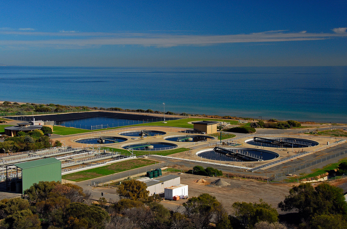
Christies Beach Wastewater treatment plant
Barbara Hardy Institute
4.4.3 Water-sensitive urban design
Water for Good builds on South Australia’s Strategic Plan target to increase the state’s recycled stormwater harvesting capacity to 35 gigalitres by 2025 (from 12.4 gigalitres in May 2012). It acknowledges the role that water-sensitive urban design (WSUD) can play in the development of creative, water-sensitive urban communities. Water for Good includes actions to introduce WSUD targets and support greater uptake of WSUD in South Australia. In 2011, the state government endorsed the release of a WSUD consultation statement, which outlined possible statewide WSUD targets to address water conservation, and the quantity and quality of run-off. Feedback on proposals in the WSUD consultation statement are assisting the development of WSUD policy recommendations for consideration by the state government.
The 30-Year Plan supports new urban development and redevelopment that contribute to sustainable management of water resources, and includes a range of policies to support WSUD. Not only will broadscale application of WSUD across the Adelaide region benefit urban waterways, including streams and wetlands, but it will also have benefits in reducing the impact of sediment and nutrient loads from stormwater on Adelaide’s coastal waters. The ACWQIP promotes the catchment-to-coast application of WSUD to improve water quality from stormwater, and reduce sediment and nutrient loads reaching the coast. Implementation of WSUD requires coordinated efforts by many groups, including the Adelaide and Mount Lofty Ranges NRM Board, local governments, a range of state agencies and local communities. Implementation of the ACWQIP will include capacity building to promote the uptake of WSUD across Adelaide.
The EPA, NRM boards, other state agencies and some local councils also promote WSUD and best-practice stormwater management guidelines in planning new developments. This is expected to provide water quality benefits for local urban streams and wetlands in the future.
4.5 Knowledge underpinning planning and policy
Science and monitoring are needed to understand the extent to which the state’s water resources are being sustainably managed, and to underpin policy development and decision-making to achieve sustainable water use. Some key initiatives that have contributed to improving our understanding of the state’s water resources are described below.
4.5.1 Goyder Institute for Water Research
The Goyder Institute for Water Research was established in 2010 to support the security and management of South Australia’s water supply and contribute to water reform in Australia. It is a partnership between the South Australian Government through DEWNR, CSIRO, Flinders University, the University of Adelaide and the University of South Australia. The institute has a $50-million, five-year research program that aims to provide independent scientific advice to inform good policy decision-making, identify future threats to water security and assist in an integrated approach to water management.
The institute’s research focuses on the themes of urban water, water for industry, environmental water and climate change. Desired outcomes that support policy are identified in cooperation with government agencies and other relevant stakeholders.
In 2010, the Goyder Institute was asked by the South Australian Government to review the science that had been used in the Guide to the proposed Basin Plan (MDBA 2010). This analysis considered whether the proposed sustainable diversion limits would meet the South Australian Government’s environmental water requirements, and assessed some of the socio-economic implications for the state. When the proposed Basin Plan was released for public consultation at the end of 2011, the South Australian Government was able to evaluate the consequences of the proposed water recovery scenario itself. In the interests of sound governance and quality assurance, the Goyder Institute was requested to provide expert judgement about the adequacy of the methods used by the South Australian Government in its evaluation of the proposed plan, to provide advice about perceived limitations in development of the plan, and to provide advice about the ecological benefits, risks and opportunities of the proposed water recovery scenario.
The Goyder Institute has also recently published reports of relevance to other areas of water resource management in the state. These include a study of approaches to modelling interactions between surface water and groundwater around drains in the south-east, and an assessment and recommendations for WSUD targets relevant to South Australian circumstances. Publications are available at: www.goyderinstitute.org/publications.
4.5.2 Department of Environment, Water and Natural Resources
DEWNR was established in 2012 through the merger of the former Department of Environment and Natural Resources and the Department for Water. It is the lead agency for policy, management and administration of the state’s water and other natural resources. A key role of DEWNR is to undertake monitoring and improve knowledge of the state’s water resources, including the potential implications of climate change.
DEWNR monitors, investigates and prepares reports on prescribed and nonprescribed water resources. Recent science and monitoring initiatives from DEWNR (including some commenced by the former Department for Water) include the following:
- analyses of Murray–Darling Basin Authority modelling scenarios to inform the state government’s response to the proposed Murray–Darling Basin Plan (Government of South Australia 2012b)—these include hydro-ecological analyses of the proposed Basin Plan with respect to the South Australian section of the River Murray and its floodplains, and the Coorong, Lower Lakes and Murray mouth.
- preparation of groundwater status reports—these provide a snapshot of the current status of groundwater resources. They include information on regional hydrogeology, groundwater-dependent ecosystems and groundwater monitoring sites (including water level and salinity trends), and an assessment of the status of the groundwater resource at current climatic and use conditions. Groundwater status reports can help decision-making about sustainable groundwater allocations, identify emerging trends in groundwater resource condition, identify risks to water supplies and determine whether further monitoring is needed.
- a Groundwater Program—this provides information to assist natural resource managers and regional industries, with a valuable insight into future opportunities to access groundwater resources from regions that are currently nonprescribed. To date, DEWNR has published nonprescribed groundwater assessments for the NRM regions of Alinytjara Wilurara, Eyre Peninsula, Kangaroo Island, Northern and Yorke, and South Australian Arid Lands.
- the Impacts of Climate Change on Water Resources project—this entails a staged approach to assessing the implications of climate change for South Australia’s water resources (both groundwater and surface water). Work to date under this project has included
- an assessment of risk and prioritisation of South Australia’s water resources for subsequent modelling of climate change impacts
- investigations of downscaling methodologies as the basis of climate impact modelling
- investigations of the impacts of climate change on the prescribed surface-water and groundwater resources of the Northern and Yorke NRM region, and on the prescribed groundwater resources and Tod catchment in the Eyre Peninsula NRM region.
- the Impacts of Climate Change on Water Resources project—this entails a staged approach to assessing the implications of climate change for South Australia’s water resources (both groundwater and surface water). Work to date under this project has included
4.5.3 Environment Protection Authority aquatic ecosystem assessments
The EPA prepares aquatic ecosystem reports on the health of South Australia’s creeks and lakes. These are designed to:
- provide a statewide monitoring framework for streams that cycles through the NRM regions with sufficient frequency to allow for regular state of the environment reporting
- describe aquatic ecosystem condition in a manner that is suitable to inform public understanding
- identify the key pressures and management responses
- provide a useful reporting format that can support environmental decision-making within government, the community and industry.
Each stream site is assessed using a descriptive model for interpreting change in aquatic ecosystems in relation to increasing levels of disturbance. The assessment uses a range of science-based approaches and models that capture the biological, chemical and physical changes occurring in South Australia’s streams and lakes.
4.5.4 WaterConnect
The state’s key water information has been brought together under a single website, WaterConnect:
www.waterconnect.sa.gov.au.
The website provides access to the most current information about South Australia’s water resources and water activities, including:
- information about current water permits, licences, allocations and approvals
- groundwater status reports
- aquatic ecosystems reports
- technical publications about the state and condition of specific water resources, including published reports on climate change impacts.
Glossy ibis
Barbara Hardy Institute
Table Set 3 South Australia’s prescribed water resources: status of water allocation plans, supply capacity and current demand by natural resource management region
-01_fmt.jpeg)
|
Adelaide and Mount Lofty Ranges |
|||||||||||||||||||||||||||||||||||||||||||||||||||||||||||||||||||||||||||||||||||||||||||||||||||
|---|---|---|---|---|---|---|---|---|---|---|---|---|---|---|---|---|---|---|---|---|---|---|---|---|---|---|---|---|---|---|---|---|---|---|---|---|---|---|---|---|---|---|---|---|---|---|---|---|---|---|---|---|---|---|---|---|---|---|---|---|---|---|---|---|---|---|---|---|---|---|---|---|---|---|---|---|---|---|---|---|---|---|---|---|---|---|---|---|---|---|---|---|---|---|---|---|---|---|---|
|
ML = megalitre; PWA = prescribed wells area; PWRA = prescribed water resources area | |||||||||||||||||||||||||||||||||||||||||||||||||||||||||||||||||||||||||||||||||||||||||||||||||||
|
Prescribed water resource |
Resource capacity |
Current demands |
|||||||||||||||||||||||||||||||||||||||||||||||||||||||||||||||||||||||||||||||||||||||||||||||||
|
Barossa PWRA |
27 147 |
9 109 |
|||||||||||||||||||||||||||||||||||||||||||||||||||||||||||||||||||||||||||||||||||||||||||||||||
|
McLaren Vale PWA |
6 560 |
2 530 |
|||||||||||||||||||||||||||||||||||||||||||||||||||||||||||||||||||||||||||||||||||||||||||||||||
|
Northern Adelaide Plains PWA |
26 500 |
11 100 |
|||||||||||||||||||||||||||||||||||||||||||||||||||||||||||||||||||||||||||||||||||||||||||||||||
|
Western Mount Lofty Ranges PWRA |
356 731 |
206 500 |
|||||||||||||||||||||||||||||||||||||||||||||||||||||||||||||||||||||||||||||||||||||||||||||||||
|
Central Adelaide PWA |
No plan |
||||||||||||||||||||||||||||||||||||||||||||||||||||||||||||||||||||||||||||||||||||||||||||||||||
|
Chapmans Creek Intake |
|||||||||||||||||||||||||||||||||||||||||||||||||||||||||||||||||||||||||||||||||||||||||||||||||||
|
Dry Creek PWA |
|||||||||||||||||||||||||||||||||||||||||||||||||||||||||||||||||||||||||||||||||||||||||||||||||||
|
Little Para prescribed watercourse |
|||||||||||||||||||||||||||||||||||||||||||||||||||||||||||||||||||||||||||||||||||||||||||||||||||
|
Middle Beach Intake |
|||||||||||||||||||||||||||||||||||||||||||||||||||||||||||||||||||||||||||||||||||||||||||||||||||
|
Northern Intake |
|||||||||||||||||||||||||||||||||||||||||||||||||||||||||||||||||||||||||||||||||||||||||||||||||||
-01_opt.jpeg)
|
Eyre Peninsula |
|||||||||||||||||||||||||||||||||||||||||||||||||||||||||||||||||||||||||||||||||||||||||||||||||||
|---|---|---|---|---|---|---|---|---|---|---|---|---|---|---|---|---|---|---|---|---|---|---|---|---|---|---|---|---|---|---|---|---|---|---|---|---|---|---|---|---|---|---|---|---|---|---|---|---|---|---|---|---|---|---|---|---|---|---|---|---|---|---|---|---|---|---|---|---|---|---|---|---|---|---|---|---|---|---|---|---|---|---|---|---|---|---|---|---|---|---|---|---|---|---|---|---|---|---|---|
|
ML = megalitre; PWA = prescribed wells area | |||||||||||||||||||||||||||||||||||||||||||||||||||||||||||||||||||||||||||||||||||||||||||||||||||
|
Prescribed water |
Resource capacity |
Current demands |
|||||||||||||||||||||||||||||||||||||||||||||||||||||||||||||||||||||||||||||||||||||||||||||||||
|
Musgrave PWA |
1 786 |
96 |
|||||||||||||||||||||||||||||||||||||||||||||||||||||||||||||||||||||||||||||||||||||||||||||||||
|
Southern Basins PWA |
8 136 |
5 631 |
|||||||||||||||||||||||||||||||||||||||||||||||||||||||||||||||||||||||||||||||||||||||||||||||||
-01_opt.jpeg)
|
Northern and Yorke |
|||||||||||||||||||||||||||||||||||||||||||||||||||||||||||||||||||||||||||||||||||||||||||||||||||
|---|---|---|---|---|---|---|---|---|---|---|---|---|---|---|---|---|---|---|---|---|---|---|---|---|---|---|---|---|---|---|---|---|---|---|---|---|---|---|---|---|---|---|---|---|---|---|---|---|---|---|---|---|---|---|---|---|---|---|---|---|---|---|---|---|---|---|---|---|---|---|---|---|---|---|---|---|---|---|---|---|---|---|---|---|---|---|---|---|---|---|---|---|---|---|---|---|---|---|---|
|
ML = megalitre; PWRA = prescribed water resources area | |||||||||||||||||||||||||||||||||||||||||||||||||||||||||||||||||||||||||||||||||||||||||||||||||||
|
Prescribed water resource |
Resource capacity |
Current demands |
|||||||||||||||||||||||||||||||||||||||||||||||||||||||||||||||||||||||||||||||||||||||||||||||||
|
Clare Valley PWRA |
20 350 |
6 100 |
|||||||||||||||||||||||||||||||||||||||||||||||||||||||||||||||||||||||||||||||||||||||||||||||||
|
Baroota PWRA |
Plan under way |
||||||||||||||||||||||||||||||||||||||||||||||||||||||||||||||||||||||||||||||||||||||||||||||||||
-01_opt.jpeg)
|
South Australian Arid Lands |
|||||||||||||||||||||||||||||||||||||||||||||||||||||||||||||||||||||||||||||||||||||||||||||||||||
|---|---|---|---|---|---|---|---|---|---|---|---|---|---|---|---|---|---|---|---|---|---|---|---|---|---|---|---|---|---|---|---|---|---|---|---|---|---|---|---|---|---|---|---|---|---|---|---|---|---|---|---|---|---|---|---|---|---|---|---|---|---|---|---|---|---|---|---|---|---|---|---|---|---|---|---|---|---|---|---|---|---|---|---|---|---|---|---|---|---|---|---|---|---|---|---|---|---|---|---|
|
ML = megalitre; PWA = prescribed wells area | |||||||||||||||||||||||||||||||||||||||||||||||||||||||||||||||||||||||||||||||||||||||||||||||||||
|
Prescribed water resource |
Resource capacity |
Current demands |
|||||||||||||||||||||||||||||||||||||||||||||||||||||||||||||||||||||||||||||||||||||||||||||||||
|
Far North PWA |
127 750 |
69 869 |
|||||||||||||||||||||||||||||||||||||||||||||||||||||||||||||||||||||||||||||||||||||||||||||||||
-01_opt.jpeg)
|
South Australian Murray–Darling Basin |
|||||||||||||||||||||||||||||||||||||||||||||||||||||||||||||||||||||||||||||||||||||||||||||||||||
|---|---|---|---|---|---|---|---|---|---|---|---|---|---|---|---|---|---|---|---|---|---|---|---|---|---|---|---|---|---|---|---|---|---|---|---|---|---|---|---|---|---|---|---|---|---|---|---|---|---|---|---|---|---|---|---|---|---|---|---|---|---|---|---|---|---|---|---|---|---|---|---|---|---|---|---|---|---|---|---|---|---|---|---|---|---|---|---|---|---|---|---|---|---|---|---|---|---|---|---|
|
ML = megalitre; PWA = prescribed wells area; PWRA = prescribed water resources area | |||||||||||||||||||||||||||||||||||||||||||||||||||||||||||||||||||||||||||||||||||||||||||||||||||
|
Prescribed water resource |
Resource capacity |
Current demands |
|||||||||||||||||||||||||||||||||||||||||||||||||||||||||||||||||||||||||||||||||||||||||||||||||
|
Eastern Mount Lofty Ranges PWRA |
188 404 |
56 540 |
|||||||||||||||||||||||||||||||||||||||||||||||||||||||||||||||||||||||||||||||||||||||||||||||||
|
Mallee PWA |
61 300 |
24 365 |
|||||||||||||||||||||||||||||||||||||||||||||||||||||||||||||||||||||||||||||||||||||||||||||||||
|
Marne Saunders PWRA |
14 605 |
4 106 |
|||||||||||||||||||||||||||||||||||||||||||||||||||||||||||||||||||||||||||||||||||||||||||||||||
|
Noora PWA |
5 138 |
28 |
|||||||||||||||||||||||||||||||||||||||||||||||||||||||||||||||||||||||||||||||||||||||||||||||||
|
Peake, Roby and Sherlock PWA |
2 489 |
1 820 |
|||||||||||||||||||||||||||||||||||||||||||||||||||||||||||||||||||||||||||||||||||||||||||||||||
|
River Murray prescribed watercourse |
6 592 000 |
573 800 |
|||||||||||||||||||||||||||||||||||||||||||||||||||||||||||||||||||||||||||||||||||||||||||||||||
|
Angas Bremer PWA |
To be included in Eastern Mount Lofty Ranges water allocation plan |
||||||||||||||||||||||||||||||||||||||||||||||||||||||||||||||||||||||||||||||||||||||||||||||||||
-01_opt.jpeg)
|
South East |
|||||||||||||||||||||||||||||||||||||||||||||||||||||||||||||||||||||||||||||||||||||||||||||||||||
|---|---|---|---|---|---|---|---|---|---|---|---|---|---|---|---|---|---|---|---|---|---|---|---|---|---|---|---|---|---|---|---|---|---|---|---|---|---|---|---|---|---|---|---|---|---|---|---|---|---|---|---|---|---|---|---|---|---|---|---|---|---|---|---|---|---|---|---|---|---|---|---|---|---|---|---|---|---|---|---|---|---|---|---|---|---|---|---|---|---|---|---|---|---|---|---|---|---|---|---|
|
ML = megalitre; PWA = prescribed wells area | |||||||||||||||||||||||||||||||||||||||||||||||||||||||||||||||||||||||||||||||||||||||||||||||||||
|
Prescribed water resource |
Resource capacity |
Current demands |
|||||||||||||||||||||||||||||||||||||||||||||||||||||||||||||||||||||||||||||||||||||||||||||||||
|
Lower Limestone Coast PWA |
756 487 |
140 587 |
|||||||||||||||||||||||||||||||||||||||||||||||||||||||||||||||||||||||||||||||||||||||||||||||||
|
Morambro Creek |
870 |
200 |
|||||||||||||||||||||||||||||||||||||||||||||||||||||||||||||||||||||||||||||||||||||||||||||||||
|
Padthaway PWA |
55 096 |
19 404 |
|||||||||||||||||||||||||||||||||||||||||||||||||||||||||||||||||||||||||||||||||||||||||||||||||
|
Tatiara PWA |
151 356 |
55 437 |
|||||||||||||||||||||||||||||||||||||||||||||||||||||||||||||||||||||||||||||||||||||||||||||||||
|
Tintinara Coonalpyn PWA |
109 100 |
22 215 |
|||||||||||||||||||||||||||||||||||||||||||||||||||||||||||||||||||||||||||||||||||||||||||||||||